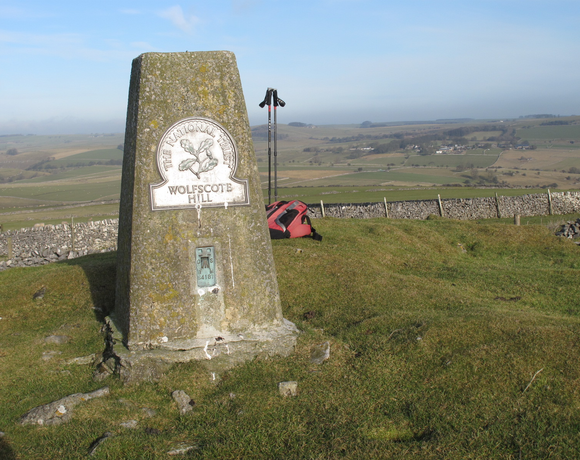
Wolfscote Hill
Wolfscote Hill is a limestone hill near the village of Hartington in the Derbyshire Peak District. The summit is 388 metres (1,273 ft) above sea level. The south side of the hill is access land, in the care of the National Trust. The land is part of the charity's White Peak estate. The 34 acres of land were bequeathed to the National Trust, with common rights, by Lady McDougall in 1939. The hill overlooks the River Dove running through Wolfscote Dale to the west, Biggin Dale to the east and Hartington to the north.
Ethel Data
- Height
- 388 metres
- Prominence
- 100 metres
- County
- Derbyshire
Map Data
- Grid Ref
- SK136583
- Lat/Lon
- 53.121703, -1.7982365
- Maps
- Google Maps - OS Maps
Recent Logged Ascents
|
Name
|
Date
|
Weather
|
Visibility
|
Source
|
|---|---|---|---|---|
|
13/11/2024
|
Cloudy
|
Poor
|
Manual
|
|
|
09/11/2024
|
Unknown
|
Unknown
|
Strava
|
|
|
30/08/2024
|
Cloudy
|
Excellent
|
Manual
|
|
|
16/08/2024
|
Unknown
|
Unknown
|
Strava
|
|
|
25/07/2023
|
Cloudy
|
Good
|
Manual
|
|
|
14/05/2022
|
Unknown
|
Unknown
|
Strava
|
|
|
04/09/2013
|
Sunny
|
Good
|
Manual
|


