Thorpe Cloud
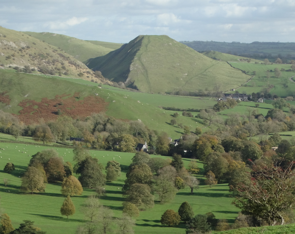
Thorpe Cloud is an isolated limestone hill (a reef knoll) lying between the villages of Thorpe and Ilam on the Derbyshire/Staffordshire border at the southern end of Dovedale. It is a popular hill amongst the many day-trippers who visit the area, and provides a fine viewpoint north up the dale and south across the Midland plain. Like much of the dale, including Bunster Hill on the opposite bank, it is in the ownership of the National Trust, and is part of their South Peak Estate. These Dovedale properties were acquired by the Trust in 1934.
Ethel Data
- Height
- 287 metres
- Prominence
- 79 metres
- County
- Derbyshire
Map Data
- Grid Ref
- SK151510
- Lat/Lon
- 53.056043, -1.7761633
- Maps
- Google Maps - OS Maps
Recent Logged Ascents
|
Name
|
Date
|
Weather
|
Visibility
|
Source
|
|---|---|---|---|---|
|
02/12/2024
|
Unknown
|
Unknown
|
Strava
|
|
|
18/10/2024
|
Cloudy
|
Very poor
|
Manual
|
|
|
10/10/2024
|
Other
|
Good
|
Manual
|
|
|
30/08/2024
|
Unknown
|
Unknown
|
Strava
|
|
|
28/08/2024
|
Sunny
|
Excellent
|
Manual
|
|
|
01/08/2024
|
Unknown
|
Unknown
|
Strava
|
|
|
11/06/2024
|
Cloudy
|
Excellent
|
Manual
|
|
|
28/04/2024
|
Unknown
|
Unknown
|
Strava
|
|
|
23/04/2024
|
Unknown
|
Unknown
|
Strava
|
|
|
26/03/2024
|
Unknown
|
Unknown
|
Strava
|
|
|
22/03/2024
|
Unknown
|
Unknown
|
Strava
|
|
|
19/03/2024
|
Unknown
|
Unknown
|
Strava
|
|
|
10/03/2024
|
Unknown
|
Unknown
|
Strava
|
|
|
08/03/2024
|
Cloudy
|
Good
|
Manual
|
|
|
06/02/2024
|
Unknown
|
Unknown
|
Strava
|
|
|
04/02/2024
|
Unknown
|
Unknown
|
Strava
|
|
|
30/01/2024
|
Unknown
|
Unknown
|
Strava
|
|
|
28/01/2024
|
Unknown
|
Unknown
|
Strava
|
|
|
17/01/2024
|
Unknown
|
Unknown
|
Strava
|
|
|
14/01/2024
|
Unknown
|
Unknown
|
Strava
|


