The Cloud
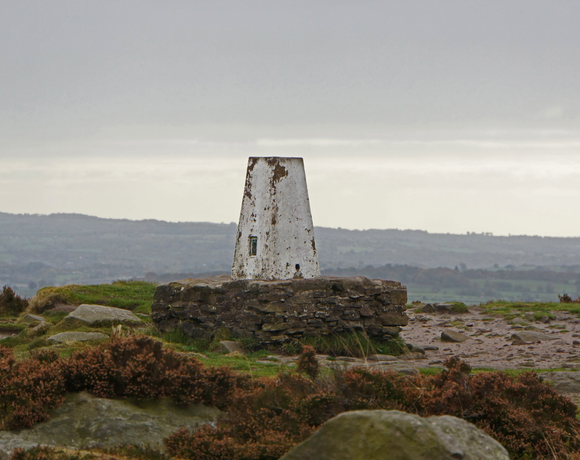
The Cloud or Bosley Cloud is a prominent hill on the border between Cheshire and Staffordshire a couple of miles west of the Peak District National Park boundary. At 343 metres (1,125 ft) in height, it is one of the highest hills in the area. Its heather-covered summit plateau is crowned by a trig point from which there are extensive views over Congleton, Biddulph, Macclesfield, Holmes Chapel and the Greater Manchester area.
Ethel Data
- Height
- 343 metres
- Prominence
- 170 metres
- County
- Cheshire / Staffordshire
Map Data
- Grid Ref
- SJ904636
- Lat/Lon
- 53.169426, -2.1450622
- Maps
- Google Maps - OS Maps
Recent Logged Ascents
|
Name
|
Date
|
Weather
|
Visibility
|
Source
|
|---|---|---|---|---|
|
27/09/2024
|
Unknown
|
Unknown
|
Strava
|
|
|
24/09/2024
|
Cloudy
|
Good
|
Manual
|
|
|
04/08/2024
|
Cloudy
|
Average
|
Manual
|
|
|
28/07/2024
|
Sunny
|
Excellent
|
Manual
|
|
|
13/07/2024
|
Unknown
|
Unknown
|
Strava
|
|
|
06/04/2024
|
Unknown
|
Unknown
|
Strava
|
|
|
05/04/2024
|
Unknown
|
Unknown
|
Strava
|
|
|
05/02/2024
|
Unknown
|
Unknown
|
Strava
|
|
|
03/02/2024
|
Unknown
|
Unknown
|
Strava
|
|
|
27/01/2024
|
Unknown
|
Unknown
|
Strava
|
|
|
13/01/2024
|
Cloudy
|
Good
|
Manual
|
|
|
07/01/2024
|
Unknown
|
Unknown
|
Strava
|
|
|
18/12/2023
|
Unknown
|
Unknown
|
Strava
|
|
|
19/11/2023
|
Unknown
|
Unknown
|
Strava
|
|
|
18/11/2023
|
Unknown
|
Unknown
|
Strava
|
|
|
11/11/2023
|
Unknown
|
Unknown
|
Strava
|
|
|
09/10/2023
|
Unknown
|
Unknown
|
Strava
|
|
|
07/10/2023
|
Unknown
|
Unknown
|
Strava
|
|
|
02/09/2023
|
Unknown
|
Unknown
|
Strava
|
|
|
02/09/2023
|
Sunny
|
Excellent
|
Manual
|


