Shutlingsloe
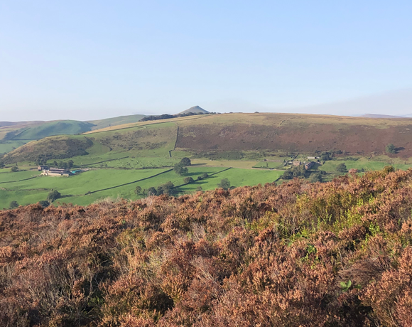
Shutlingsloe is a hill near the village of Wildboarclough, in the east of the county of Cheshire. It stands to the south of Macclesfield Forest, on the edge of the Peak District and within the Peak District National Park. A steep-sided hill with a distinctive profile, sometimes described as the 'Matterhorn of Cheshire', it is the third highest peak in the historic county with an elevation of 506 m (1,660 ft) and commands excellent views over Cheshire.
Ethel Data
- Height
- 506 metres
- Prominence
- 134 metres
- County
- Cheshire
Map Data
- Grid Ref
- SJ976695
- Lat/Lon
- 53.222543, -2.0374038
- Maps
- Google Maps - OS Maps
Recent Logged Ascents
|
Name
|
Date
|
Weather
|
Visibility
|
Source
|
|---|---|---|---|---|
|
27/11/2024
|
Unknown
|
Unknown
|
Strava
|
|
|
27/09/2024
|
Wind
|
Good
|
Manual
|
|
|
20/09/2024
|
Unknown
|
Unknown
|
Strava
|
|
|
16/08/2024
|
Cloudy
|
Excellent
|
Manual
|
|
|
14/08/2024
|
Unknown
|
Unknown
|
Strava
|
|
|
09/08/2024
|
Unknown
|
Unknown
|
Strava
|
|
|
02/08/2024
|
Sunny
|
Good
|
Manual
|
|
|
30/07/2024
|
Unknown
|
Unknown
|
Strava
|
|
|
23/07/2024
|
Unknown
|
Unknown
|
Strava
|
|
|
12/07/2024
|
Unknown
|
Unknown
|
Strava
|
|
|
07/07/2024
|
Unknown
|
Unknown
|
Strava
|
|
|
05/07/2024
|
Unknown
|
Unknown
|
Strava
|
|
|
21/06/2024
|
Unknown
|
Unknown
|
Strava
|
|
|
02/06/2024
|
Unknown
|
Unknown
|
Strava
|
|
|
17/05/2024
|
Unknown
|
Unknown
|
Strava
|
|
|
12/05/2024
|
Unknown
|
Unknown
|
Strava
|
|
|
19/04/2024
|
Unknown
|
Unknown
|
Strava
|
|
|
31/03/2024
|
Unknown
|
Unknown
|
Strava
|
|
|
01/03/2024
|
Unknown
|
Unknown
|
Strava
|
|
|
28/01/2024
|
Unknown
|
Unknown
|
Strava
|


