Merryton Low
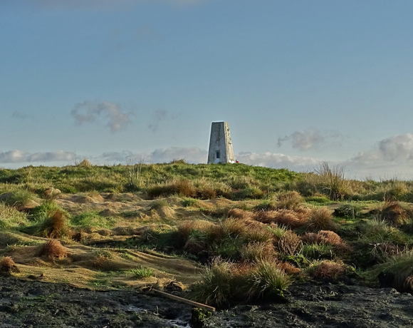
Merryton Low is a hill in Staffordshire, England, a few miles east of Leek. It is in the civil parish of Fawfieldhead in the local government district of Staffordshire Moorlands. The hill is 489m / 1604 ft ASL and forms part of the White Peak and is within the Peak District National Park
Ethel Data
- Height
- 489 metres
- Prominence
- 54 metres
- County
- Staffordshire
Map Data
- Grid Ref
- SK041610
- Lat/Lon
- 53.146128, -1.9401559
- Maps
- Google Maps - OS Maps
Recent Logged Ascents
|
Name
|
Date
|
Weather
|
Visibility
|
Source
|
|---|---|---|---|---|
|
10/10/2024
|
Other
|
Good
|
Manual
|
|
|
31/08/2024
|
Unknown
|
Unknown
|
Strava
|
|
|
18/07/2024
|
Sunny
|
Good
|
Manual
|
|
|
17/07/2024
|
Sunny
|
Excellent
|
Manual
|
|
|
27/06/2024
|
Cloudy
|
Good
|
Manual
|
|
|
25/05/2024
|
Unknown
|
Unknown
|
Strava
|
|
|
25/05/2024
|
Unknown
|
Unknown
|
Strava
|
|
|
15/05/2024
|
Sunny
|
Good
|
Manual
|
|
|
06/04/2024
|
Unknown
|
Unknown
|
Strava
|
|
|
17/03/2024
|
Unknown
|
Unknown
|
Strava
|
|
|
17/03/2024
|
Unknown
|
Unknown
|
Strava
|
|
|
01/12/2023
|
Sunny
|
Excellent
|
Manual
|
|
|
26/11/2023
|
Unknown
|
Unknown
|
Strava
|
|
|
09/11/2023
|
Cloudy
|
Good
|
Manual
|
|
|
07/10/2023
|
Unknown
|
Unknown
|
Strava
|
|
|
12/01/2023
|
Unknown
|
Unknown
|
Strava
|
|
|
22/02/2022
|
Wind
|
Good
|
Manual
|
|
|
21/10/2021
|
Unknown
|
Unknown
|
Strava
|
|
|
12/06/2013
|
Cloudy
|
Good
|
Manual
|


