Lost Lad
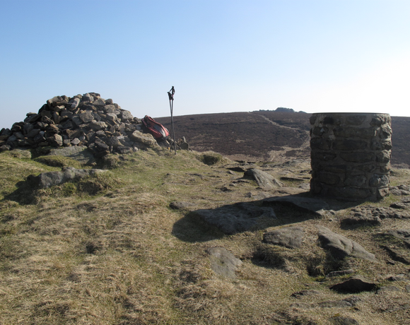
Lost Lad is a hill, 518 metres (1,699 ft) high on the Derwent Edge in the Peak District in the county of Derbyshire in England. It is a subpeak of Back Tor 538 metres (1,765 ft). Lost Lad is a bare, conical moorland summit and subpeak of the nearby Back Tor which rises about 600 metres to the southeast. The top of Lost Lad is marked by a cairn and toposcope and there are good views over the surrounding northern Peak District.
Ethel Data
- Height
- 518 metres
- Prominence
- 10 metres
- County
- Derbyshire / South Yorkshire
Map Data
- Grid Ref
- SK193912
- Lat/Lon
- 53.417254, -1.7110806
- Maps
- Google Maps - OS Maps
Recent Logged Ascents
|
Name
|
Date
|
Weather
|
Visibility
|
Source
|
|---|---|---|---|---|
|
27/10/2024
|
Unknown
|
Unknown
|
Strava
|
|
|
22/10/2024
|
Cloudy
|
Good
|
Manual
|
|
|
20/10/2024
|
Sunny
|
Excellent
|
Manual
|
|
|
19/08/2024
|
Unknown
|
Unknown
|
Strava
|
|
|
11/08/2024
|
Sunny
|
Good
|
Manual
|
|
|
08/07/2024
|
Unknown
|
Unknown
|
Strava
|
|
|
29/06/2024
|
Unknown
|
Unknown
|
Strava
|
|
|
29/06/2024
|
Unknown
|
Unknown
|
Strava
|
|
|
16/06/2024
|
Unknown
|
Unknown
|
Strava
|
|
|
09/06/2024
|
Unknown
|
Unknown
|
Strava
|
|
|
08/06/2024
|
Unknown
|
Unknown
|
Strava
|
|
|
06/06/2024
|
Unknown
|
Unknown
|
Strava
|
|
|
05/05/2024
|
Sunny
|
Good
|
Manual
|
|
|
27/04/2024
|
Unknown
|
Unknown
|
Strava
|
|
|
26/03/2024
|
Unknown
|
Unknown
|
Strava
|
|
|
02/03/2024
|
Unknown
|
Unknown
|
Strava
|
|
|
25/02/2024
|
Unknown
|
Unknown
|
Strava
|
|
|
12/02/2024
|
Unknown
|
Unknown
|
Strava
|
|
|
07/02/2024
|
Unknown
|
Unknown
|
Strava
|
|
|
01/02/2024
|
Sunny
|
Excellent
|
Manual
|


