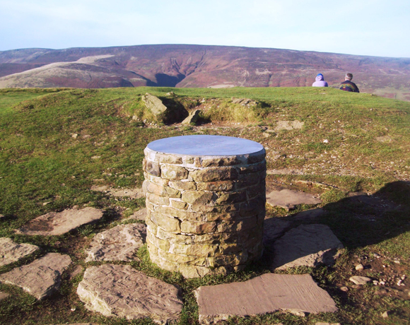
Lose Hill
Lose Hill lies in the Derbyshire Peak District. It is the south-east corner of the parish of Edale and the end of the Great Ridge that runs from Rushup Edge to the west (over Mam Tor, Hollins Cross and Back Tor). Local access activist G. H. B. Ward was given an area of Lose Hill by the Sheffield and District Federation of the Ramblers Association in 1945, which was named Ward's Piece; he subsequently presented this to the National Trust.
Ethel Data
- Height
- 476 metres
- Prominence
- 76 metres
- County
- Derbyshire
Map Data
- Grid Ref
- SK153854
- Lat/Lon
- 53.365251, -1.7715424
- Maps
- Google Maps - OS Maps
Recent Logged Ascents
|
Name
|
Date
|
Weather
|
Visibility
|
Source
|
|---|---|---|---|---|
|
28/11/2024
|
Unknown
|
Unknown
|
Strava
|
|
|
17/11/2024
|
Unknown
|
Unknown
|
Strava
|
|
|
12/11/2024
|
Unknown
|
Unknown
|
Strava
|
|
|
10/10/2024
|
Other
|
Good
|
Manual
|
|
|
29/09/2024
|
Unknown
|
Unknown
|
Strava
|
|
|
28/09/2024
|
Unknown
|
Unknown
|
Strava
|
|
|
18/09/2024
|
Unknown
|
Unknown
|
Strava
|
|
|
14/09/2024
|
Unknown
|
Unknown
|
Strava
|
|
|
18/08/2024
|
Unknown
|
Unknown
|
Strava
|
|
|
15/08/2024
|
Unknown
|
Unknown
|
Strava
|
|
|
11/08/2024
|
Unknown
|
Unknown
|
Strava
|
|
|
11/08/2024
|
Unknown
|
Unknown
|
Strava
|
|
|
11/08/2024
|
Unknown
|
Unknown
|
Strava
|
|
|
02/08/2024
|
Unknown
|
Unknown
|
Strava
|
|
|
02/08/2024
|
Cloudy
|
Good
|
Manual
|
|
|
31/07/2024
|
Fog
|
Average
|
Manual
|
|
|
27/07/2024
|
Cloudy
|
Average
|
Manual
|
|
|
27/06/2024
|
Unknown
|
Unknown
|
Strava
|
|
|
25/06/2024
|
Unknown
|
Unknown
|
Strava
|
|
|
23/06/2024
|
Unknown
|
Unknown
|
Strava
|


