Gun
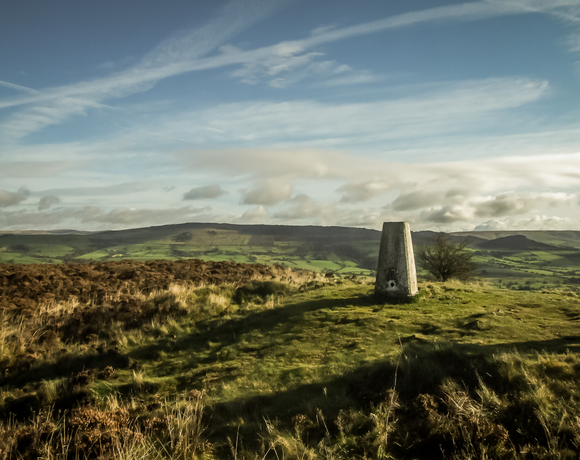
Gun is a hill at the southern end of the Peak District, overlooking the town of Leek in the Staffordshire Moorlands. The hill is mainly moorland with some small wooded areas. Neighbouring peaks to the east are The Roaches, Hen Cloud and Ramshaw Rocks. It is a nature reserve of the Staffordshire Wildlife Trust.
Ethel Data
- Height
- 385 metres
- Prominence
- 168 metres
- County
- Staffordshire
Map Data
- Grid Ref
- SJ970615
- Lat/Lon
- 53.150629, -2.0463123
- Maps
- Google Maps - OS Maps
Recent Logged Ascents
|
Name
|
Date
|
Weather
|
Visibility
|
Source
|
|---|---|---|---|---|
|
18/01/2025
|
Fog
|
Very poor
|
Manual
|
|
|
10/10/2024
|
Other
|
Good
|
Manual
|
|
|
28/09/2024
|
Unknown
|
Unknown
|
Strava
|
|
|
04/08/2024
|
Cloudy
|
Average
|
Manual
|
|
|
03/08/2024
|
Sunny
|
Excellent
|
Manual
|
|
|
15/05/2024
|
Sunny
|
Good
|
Manual
|
|
|
15/05/2024
|
Rain
|
Average
|
Manual
|
|
|
06/04/2024
|
Unknown
|
Unknown
|
Strava
|
|
|
06/04/2024
|
Unknown
|
Unknown
|
Strava
|
|
|
05/04/2024
|
Unknown
|
Unknown
|
Strava
|
|
|
08/03/2024
|
Unknown
|
Unknown
|
Strava
|
|
|
02/02/2024
|
Unknown
|
Unknown
|
Strava
|
|
|
09/10/2023
|
Unknown
|
Unknown
|
Strava
|
|
|
03/12/2022
|
Unknown
|
Unknown
|
Strava
|
|
|
02/09/2022
|
Unknown
|
Unknown
|
Strava
|
|
|
06/05/2015
|
Cloudy
|
Average
|
Manual
|
|
|
27/02/2015
|
Cloudy
|
Average
|
Manual
|


