Cats Tor
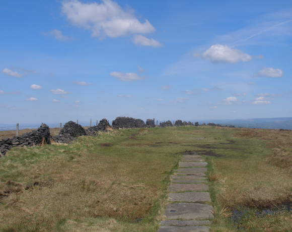
Cats Tor is a Peak District hill on the border between Cheshire and Derbyshire, between the towns of Macclesfield and Buxton. The summit is 518 metres (1,699 ft) above sea level. Tor is an Old English word for a high, rocky hill. Cats Tor is a popular location for paragliding, used by the Derbyshire Soaring Club and the Peak Soaring Association.
Ethel Data
- Height
- 518 metres
- Prominence
- 35 metres
- County
- Cheshire / Derbyshire
Map Data
- Grid Ref
- SJ995759
- Lat/Lon
- 53.280077, -2.0089589
- Maps
- Google Maps - OS Maps
Recent Logged Ascents
|
Name
|
Date
|
Weather
|
Visibility
|
Source
|
|---|---|---|---|---|
|
18/01/2025
|
Unknown
|
Unknown
|
Strava
|
|
|
10/10/2024
|
Other
|
Good
|
Manual
|
|
|
31/08/2024
|
Unknown
|
Unknown
|
Strava
|
|
|
29/08/2024
|
Unknown
|
Unknown
|
Strava
|
|
|
10/08/2024
|
Unknown
|
Unknown
|
Strava
|
|
|
18/07/2024
|
Unknown
|
Unknown
|
Strava
|
|
|
13/07/2024
|
Unknown
|
Unknown
|
Strava
|
|
|
24/06/2024
|
Sunny
|
Good
|
Manual
|
|
|
23/06/2024
|
Unknown
|
Unknown
|
Strava
|
|
|
08/06/2024
|
Unknown
|
Unknown
|
Strava
|
|
|
07/06/2024
|
Unknown
|
Unknown
|
Strava
|
|
|
18/05/2024
|
Unknown
|
Unknown
|
Strava
|
|
|
08/05/2024
|
Unknown
|
Unknown
|
Strava
|
|
|
17/04/2024
|
Unknown
|
Unknown
|
Strava
|
|
|
27/03/2024
|
Unknown
|
Unknown
|
Strava
|
|
|
16/03/2024
|
Unknown
|
Unknown
|
Strava
|
|
|
29/02/2024
|
Cloudy
|
Good
|
Manual
|
|
|
23/02/2024
|
Unknown
|
Unknown
|
Strava
|
|
|
20/02/2024
|
Unknown
|
Unknown
|
Strava
|
|
|
28/01/2024
|
Wind
|
Good
|
Manual
|


