Burbage Edge (Goyt's Moss)
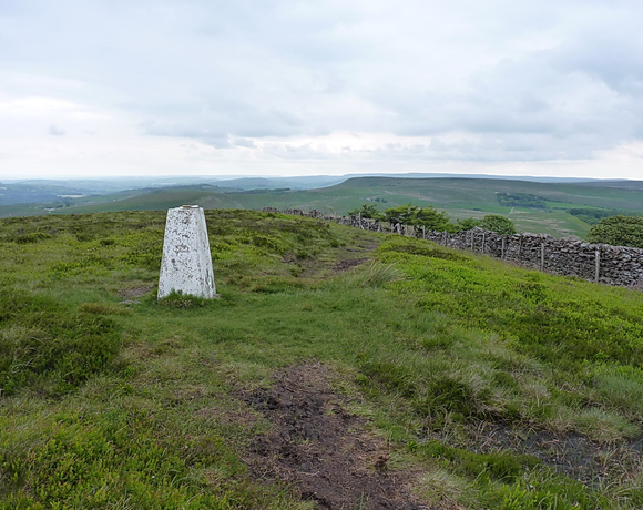
Burbage Edge is a gritstone escarpment overlooking the Burbage district of Buxton in Derbyshire, in the Peak District. The hill's summit (marked by a trig pillar) is 500 metres (1,600 ft) above sea level. The boundary of the Peak District National Park runs along the ridge and across the summit. The ridge of Burbage Edge marks the western gritstone edge of the Derbyshire Dome, extending south as Axe Edge and to the north as Combs Moss.
Ethel Data
- Height
- 500 metres
- Prominence
- 25 metres
- County
- Derbyshire
Map Data
- Grid Ref
- SK029732
- Lat/Lon
- 53.2558, -1.9579906
- Maps
- Google Maps - OS Maps
Recent Logged Ascents
|
Name
|
Date
|
Weather
|
Visibility
|
Source
|
|---|---|---|---|---|
|
29/12/2024
|
Unknown
|
Unknown
|
Strava
|
|
|
30/11/2024
|
Unknown
|
Unknown
|
Strava
|
|
|
24/11/2024
|
Unknown
|
Unknown
|
Strava
|
|
|
10/10/2024
|
Other
|
Good
|
Manual
|
|
|
23/09/2024
|
Unknown
|
Unknown
|
Strava
|
|
|
12/08/2024
|
Unknown
|
Unknown
|
Strava
|
|
|
09/08/2024
|
Sunny
|
Excellent
|
Manual
|
|
|
18/07/2024
|
Sunny
|
Good
|
Manual
|
|
|
03/07/2024
|
Unknown
|
Unknown
|
Strava
|
|
|
13/04/2024
|
Unknown
|
Unknown
|
Strava
|
|
|
28/02/2024
|
Rain
|
Average
|
Manual
|
|
|
24/02/2024
|
Unknown
|
Unknown
|
Strava
|
|
|
14/10/2023
|
Unknown
|
Unknown
|
Strava
|
|
|
07/10/2023
|
Unknown
|
Unknown
|
Strava
|
|
|
18/09/2023
|
Unknown
|
Unknown
|
Strava
|
|
|
17/08/2023
|
Sunny
|
Excellent
|
Manual
|
|
|
07/08/2023
|
Cloudy
|
Excellent
|
Manual
|
|
|
05/06/2023
|
Sunny
|
Good
|
Manual
|
|
|
27/05/2023
|
Sunny
|
Excellent
|
Manual
|
|
|
01/05/2023
|
Unknown
|
Unknown
|
Strava
|


