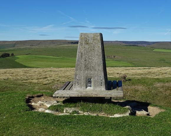
Bradwell Moor
Bradwell Moor is a moorland hill above the village of Bradwell, Derbyshire in the Peak District. The summit is 471 metres (1,545 ft) above sea level. Batham Gate Roman road ran across the moor, from nearby Navio Roman fort (at Brough-on-Noe) to Aquae Arnemetiae (Buxton). Batham Gate is Old English for "road to the bath town". Clement Lane follows the original route across the moor. The section of Batham Gate road east of Peak Forest is a protected Scheduled Monument.
Ethel Data
- Height
- 471 metres
- Prominence
- 50 metres
- County
- Derbyshire
Map Data
- Grid Ref
- SK132801
- Lat/Lon
- 53.317668, -1.803319
- Maps
- Google Maps - OS Maps
Recent Logged Ascents
|
Name
|
Date
|
Weather
|
Visibility
|
Source
|
|---|---|---|---|---|
|
29/12/2024
|
Unknown
|
Unknown
|
Strava
|
|
|
09/08/2024
|
Sunny
|
Good
|
Manual
|
|
|
05/08/2024
|
Cloudy
|
Good
|
Manual
|
|
|
04/07/2024
|
Unknown
|
Unknown
|
Strava
|
|
|
25/06/2024
|
Cloudy
|
Good
|
Manual
|
|
|
12/06/2024
|
Unknown
|
Unknown
|
Strava
|
|
|
02/06/2024
|
Unknown
|
Unknown
|
Strava
|
|
|
19/03/2024
|
Unknown
|
Unknown
|
Strava
|
|
|
15/03/2024
|
Unknown
|
Unknown
|
Strava
|
|
|
15/03/2024
|
Unknown
|
Unknown
|
Strava
|
|
|
05/02/2024
|
Cloudy
|
Excellent
|
Manual
|
|
|
07/01/2024
|
Cloudy
|
Good
|
Manual
|
|
|
17/11/2023
|
Unknown
|
Unknown
|
Strava
|
|
|
17/11/2023
|
Unknown
|
Unknown
|
Strava
|
|
|
23/09/2023
|
Unknown
|
Unknown
|
Strava
|
|
|
22/09/2023
|
Unknown
|
Unknown
|
Strava
|
|
|
13/08/2023
|
Unknown
|
Unknown
|
Strava
|
|
|
28/05/2023
|
Sunny
|
Good
|
Manual
|
|
|
23/11/2016
|
Cloudy
|
Average
|
Manual
|
|
|
23/07/0024
|
Cloudy
|
Good
|
Manual
|


