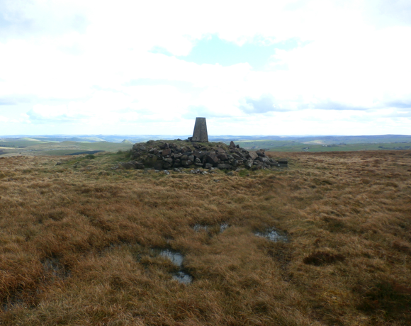
Axe Edge Moor
Axe Edge Moor is the major moorland southwest of Buxton in the Peak District. It is mainly gritstone. This is slightly lower than Shining Tor. The moor is the source of the River Dove, River Manifold, River Dane, River Wye and River Goyt. Wikipedia
Ethel Data
- Height
- 551 metres
- Prominence
- 84 metres
- County
- Derbyshire
Map Data
- Grid Ref
- SK035706
- Lat/Lon
- 53.232426, -1.9490248
- Maps
- Google Maps - OS Maps
Recent Logged Ascents
|
Name
|
Date
|
Weather
|
Visibility
|
Source
|
|---|---|---|---|---|
|
29/12/2024
|
Unknown
|
Unknown
|
Strava
|
|
|
24/11/2024
|
Unknown
|
Unknown
|
Strava
|
|
|
10/10/2024
|
Other
|
Average
|
Manual
|
|
|
09/09/2024
|
Wind
|
Good
|
Manual
|
|
|
02/09/2024
|
Unknown
|
Unknown
|
Strava
|
|
|
01/09/2024
|
Unknown
|
Unknown
|
Strava
|
|
|
22/07/2024
|
Unknown
|
Unknown
|
Strava
|
|
|
19/07/2024
|
Unknown
|
Unknown
|
Strava
|
|
|
17/07/2024
|
Sunny
|
Excellent
|
Manual
|
|
|
22/06/2024
|
Sunny
|
Good
|
Manual
|
|
|
29/03/2024
|
Unknown
|
Unknown
|
Strava
|
|
|
13/03/2024
|
Unknown
|
Unknown
|
Strava
|
|
|
26/02/2024
|
Sunny
|
Good
|
Manual
|
|
|
24/02/2024
|
Unknown
|
Unknown
|
Strava
|
|
|
09/01/2024
|
Unknown
|
Unknown
|
Strava
|
|
|
20/12/2023
|
Cloudy
|
Average
|
Manual
|
|
|
05/12/2023
|
Unknown
|
Unknown
|
Strava
|
|
|
07/08/2023
|
Cloudy
|
Excellent
|
Manual
|
|
|
06/08/2023
|
Unknown
|
Unknown
|
Strava
|
|
|
29/06/2023
|
Unknown
|
Unknown
|
Strava
|


